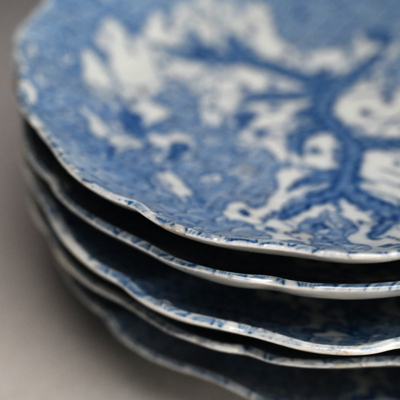
A fascinating set of five late-Edo blue-and-white porcelain map dishes featuring the southern main Island of Kyushu spreading across a sea of tempestuous waves dotted with tiny islands. Above the tip of Honshu extnds down to toward the island, with Shikoku extending fingers of land from the right. Kyushu itself is divided by mountain ranges forming an undulating series of spines, with rivers flowing between the plains. The various ancient state names are connected by “Highways” marked in dotted lines, the ancient Kaido which unified the country. Produced at the Arita kilns during a period of intense popular interest in travel and geography, map dishes transformed cartography into ornament: provinces, routes and place names invite the eye to journey across a miniature Japan held quite literally in the hand. Such dishes reflect not scientific cartography alone, but the geographical awareness which came from Rangaku (Dutch studies) and the recognition after 200 years of isolation that Japan was not alone among the seas. The close photographs also show how wonderfully eccentric the information can become. Large characters coexist with tiny inscriptions; dotted lines, mountains and boundaries snake between provinces; some writing becomes almost absorbed into the ornament. These are small individual dishes and, remarkably, a surviving set of five. Rather than geography presented monumentally on a display charger as was typical of chizuzara, the map becomes intimate—something encountered directly in the hand and around the dining or drinking setting. What is even more important, sets inevitably became dispersed through use, breakage and the antiques trade. A complete set of five is unprecedented. They are 21.5 cm (8-1/2 inches) diameter, roughly 3.5 cm (1-1/2 inches) tall and in overall excellent condition.
This set of dishes belong to the late-Edo tradition of Imari/Arita map dishes (chizuzara), which flourished especially around the Tempō era (1830–1844). Major examples with remarkably similar cartographic conventions are preserved in the Tokyo National Museum, Kyushu National Museum, Kobe City Museum, and Toguri Museum. What makes this group especially appealing is that these are not simply dishes decorated with something vaguely resembling a map. They belong to a fascinating moment when geography itself became a decorative subject. Japanese map dishes existed before the nineteenth century. The Kyushu National Museum specifically notes their earlier history and points to the map-decorated ceramics associated with Hiraga Gennai (1728–1780) in the eighteenth century. By the late Edo period, however, Arita potters began producing blue-and-white porcelain map dishes in appreciable numbers. The sea is covered with seigaiha, the familiar overlapping wave pattern. Against this wonderfully abstract ocean floats Japan, with provincial names, important places, routes or divisions, islands and surrounding territories compressed into a highly decorative cartographic form. The irregular, almost organic rim reinforces the impression that one is looking down upon a world surrounded by water. Importantly, these were not intended as accurate navigational maps. The Japan represented on many Imari map dishes derives from the much older convention generally called the Gyōki-style map. The Kobe City Museum specifically identifies this simplified cartographic tradition in Imari map dishes. That distinction is culturally important. By the nineteenth century Japan possessed far more sophisticated geographical knowledge. Inō Tadataka's surveying project, for example, had produced extraordinarily accurate maps of the archipelago during the early nineteenth century. Yet potters continued to reproduce the older, immediately recognizable cartographic image. In other words, the map on the dish was an image of Japan rather than simply information about Japan. his is where map dishes become much more interesting culturally. Late Edo Japan experienced an enormous expansion in travel, pilgrimage, publishing, illustrated guidebooks, famous-place imagery (meisho-e), route maps and popular geographical knowledge. The country was politically unified and increasingly interconnected by roads, pilgrimage networks and commercial exchange. A person might never travel throughout Japan, but could increasingly imagine Japan as a geographical whole. Map dishes participated in that culture. There is something almost playful about turning geography into a serving vessel. The owner literally possessed a miniature representation of the country, something that could be picked up, examined and discussed. Province names became part of the decoration, inviting the eye to wander from place to place. These certainly communicate geographical knowledge, but their appeal seems broader: curiosity, travel, visual culture and an emerging popular consciousness of the Japanese archipelago as a single interconnected place.